Patrick AFB Drawing #AW 60-084178
Civil Engineering Construction Plans, Complex 34,
November 30th, 1961
Map.jpg - 4000 x 3000 - 1.28 Megs
Scale: 1 Pixel = 1 Foot
This was scanned from a very large, very dark blueprint I received from NASA's KSC Archives. I've partially cleaned it up for clarity.
 
Master Plan for Launch Complex 34
Source: Moonport: A History of Apollo Launch Facilites and Operations
NASA SP-4204, Published 1978
Masterplan.jpg - 1950 x 1595 - 496 K
Scale: 70 Pixels = 100 Feet
Not the prettiest image, but has the best overall nomenclature I've found. The distortion at the top is from filling in an incomplete image with a lower-res substitute.
 
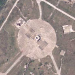
USGS Aerial Photo
Taken March 18th, 1994
USGS.jpg - 1600 x 1600 - 391 K
Scale: 1 Pixel = 1 Meter
I pulled this image down in sections from the USGS site, assembled it, then adjusted the brightness of key tiles to even out he mosaic.
 
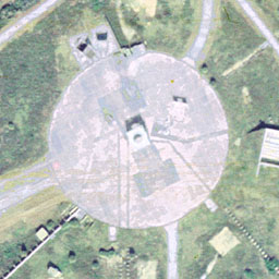
U.S. Micromaps Aerial Photo
Micromap.jpg - 3600 x 2600 - 1.3 Megs
Aprrox. Scale: 1 pixel = 0.8 feet
A bit posterized, but otherwise, a great color aerial image.
 
Patrick AFB Drawing #AW 60-084178
Sheets 5, 5A and 6
Civil Engineering Construction Plans, Complex 34,
October 19th, 1960
Overlay.jpg - 3600 x 2600 - 971 K
Aprrox. Scale: 1 pixel = 0.8 feet
This image is assembled from three different topographic plans, then scaled and oriented to match the MicroMaps image as closely as possible. With the images being exactly the same size, this diagram can be superimposed over the color image quite easily.
 
Mapquest Aerial Photo
Mapquest.jpg - 822 x 909 - 154 K
Aprrox. Scale: 1 pixel = 3.16 feet
Lower resolution than the MicroMaps image, but much better, more natural color.


This page last updated on August 19th, 2002